Fotos del Lago de Maracaibo, botes de petróleo, 2003.01.20
gracias a los amigos que mandaron estas fotos
(Al "clikear" las fotos, estas crecen)
http://earthobservatory.nasa.gov/Newsroom/NewImages/images.php3?img_id=15312
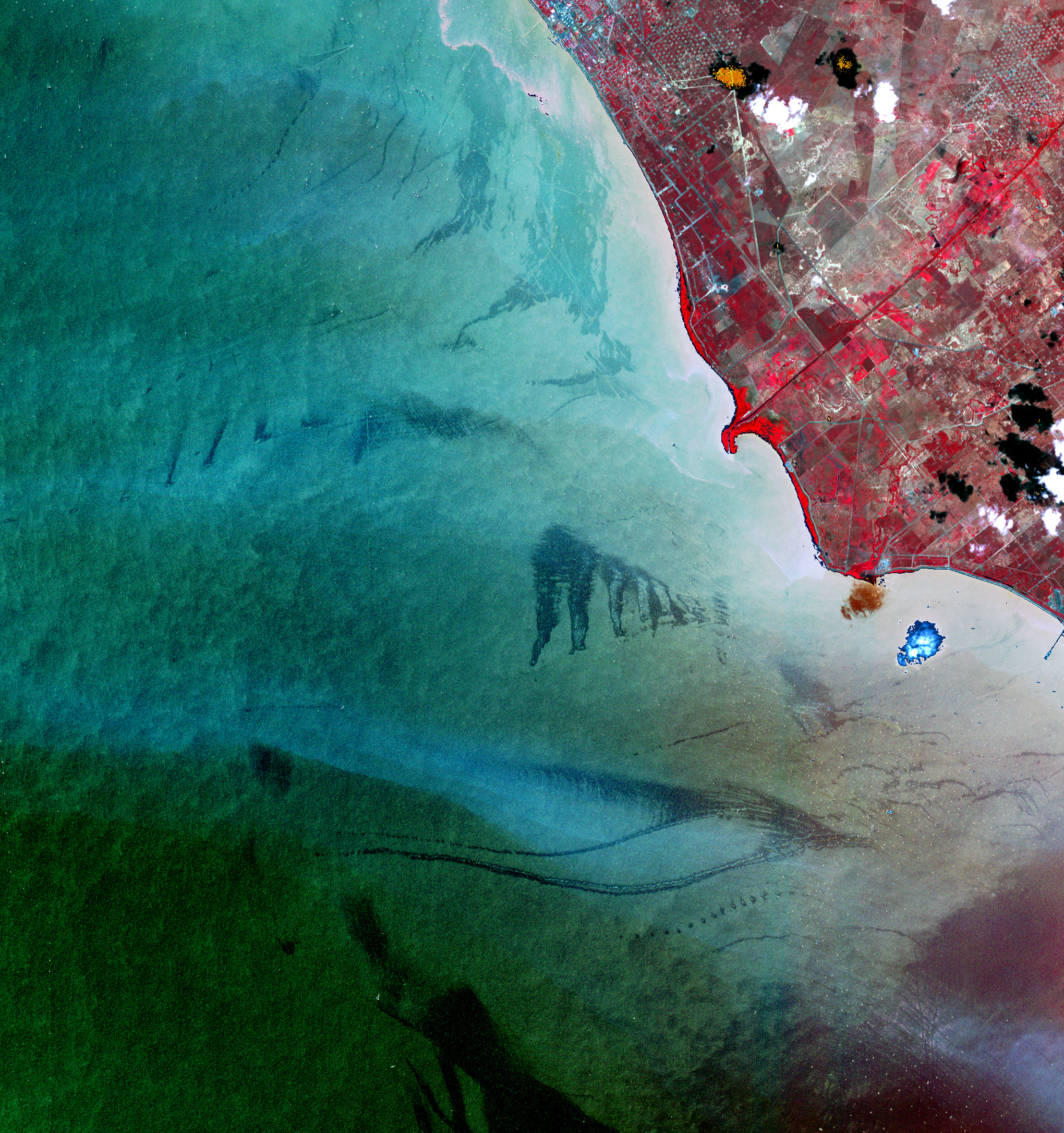
This false-color (near-infrared, red, green) image of Lake Maracaibo, Venezuela, has been processed to emphasize details on the lake’s surface. The scene shows oil slicks (the various dark patches) in the southeastern portion of the lake on January 20, 2003. The slicks come from leaks in the various oil production and storage platforms located on Lake Maracaibo. Venezuela is the largest oil producing nation in the Western Hemisphere.
This image was produced using data from the Advanced Spaceborne Thermal Emission and Reflection Radiometer (ASTER) flying aboard NASA’s Terra satellite. The scene uses the sensor’s near-infrared, red, and green bands (3, 2, and 1), which were then “stretched” to highlight the contrast of the oil slicks with the unpolluted water. The water and land components of this scene were processed and stretched separately and then “stitched” back together into one image; this stitching is evident along the shoreline in the high-resolution version of this image. On land, the red color indicates vegetated areas, the bluish areas show paved surfaces, and the browns are bare land. At full resolution, this scene is 15 meters per pixel and spans an area of 900 square km.
To learn more about Lake Maracaibo and to see images from the Terra Multi-angle Imaging Spectroradiometer (MISR), read Oil Slicks on Lake Maracaibo, Venezuela.
Image courtesy NASA Earth Observatory
http://earthobservatory.nasa.gov/Newsroom/NewImages/images.php3?img_id=15292